Construction Progress Monitoring Software: The Complete 2026 Buyer's Guide
Construction progress monitoring software is a category of tools that automatically captures, measures, and reports physical progress on a job site — without sending a person to walk it. In 2026, the best platforms combine satellite imagery, computer-vision change detection, and structured PDF reporting so lenders, developers, and asset managers can verify what's actually built before releasing capital.
This guide explains how the technology works, what to look for when evaluating vendors, realistic pricing, and where satellite-based monitoring outperforms drones, fixed jobsite cameras, and traditional field-app workflows.
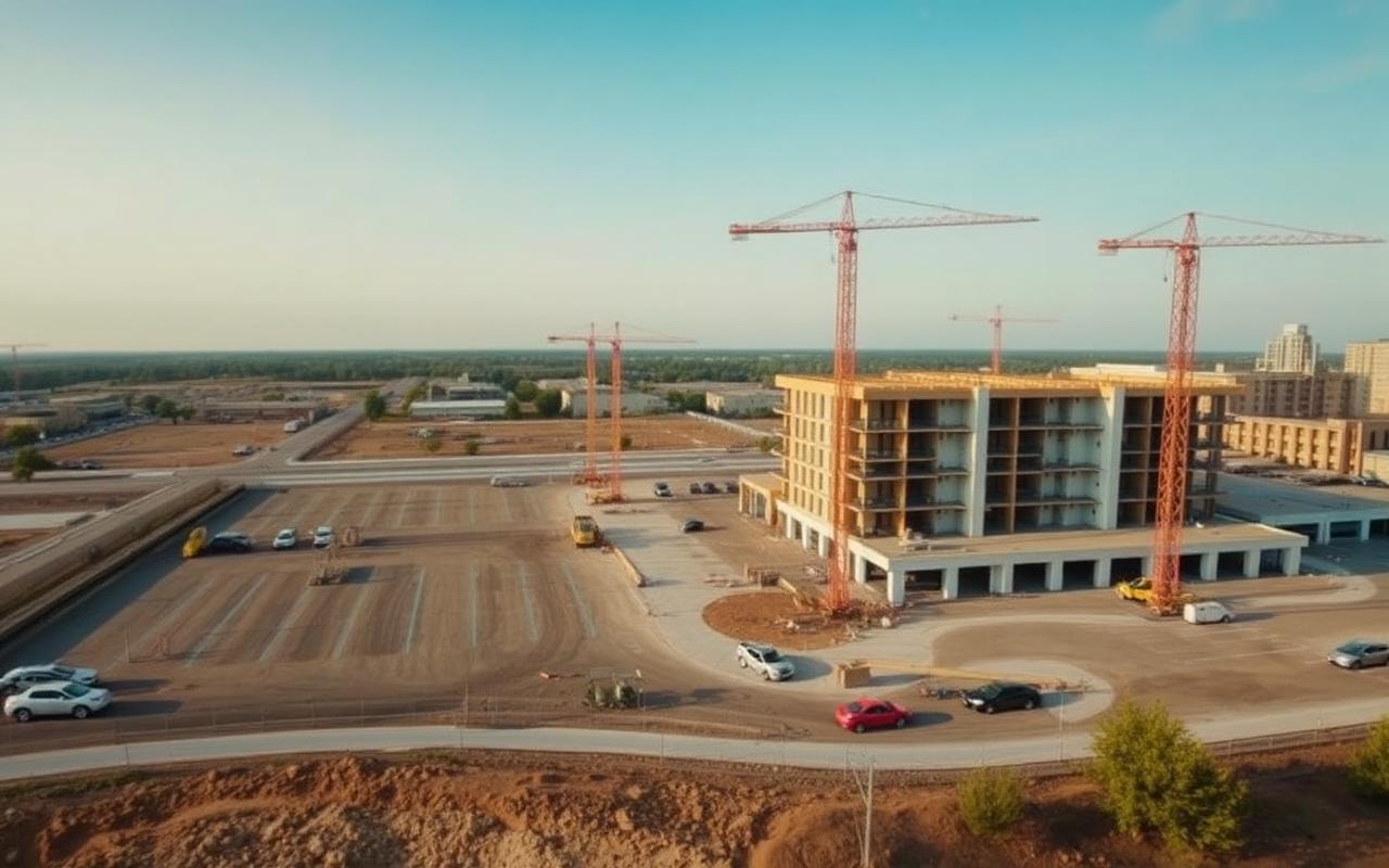
What is construction progress monitoring software? At its core, it's any system that produces an objective, time-stamped record of construction progress. Older categories — daily-log apps, photo-uploaders, and jobsite camera feeds — still depend on a human being on site. Modern remote-sensing platforms like Terra Trace IQ replace that human step with satellite captures processed by AI, so progress is verified continuously from orbit rather than episodically from a clipboard.
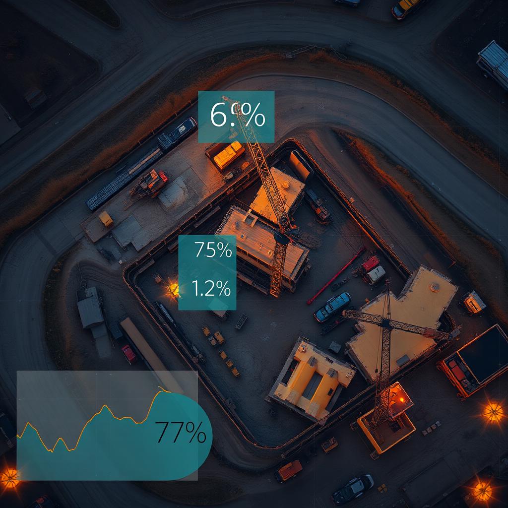
How it works in four steps: (1) the user drops a pin on the project's geofence; (2) the platform tasks a multi-source satellite stack (Sentinel-2 at 10m/pixel, Landsat-9, and sub-meter commercial providers when needed) on a 3–5 day revisit cycle; (3) computer-vision models compare every new capture against the prior baseline and quantify change — earthwork, foundation pours, framing, dry-in, paving; (4) results render to an interactive dashboard plus a structured PDF report that maps directly to a construction draw schedule.
Why lenders and developers are migrating from in-person inspections: a single third-party draw inspection runs $1,200–$3,500 once travel, labor, and reporting are included. Quarterly inspections over a 24-month loan total roughly $16,000 per project. Satellite-based monitoring at $149–$199/site/month delivers weekly updates for $3,576 over the same term — a ~78% reduction in direct cost with dramatically better cadence. More importantly, satellite imagery is objective; it has no incentive to overstate progress.
Features that actually matter when evaluating a vendor. Resolution and revisit cadence: 10m/pixel is enough to see foundation slabs, structural steel, large equipment, and pavement on commercial pads; sub-meter is needed only for small residential infill. Revisit should be 3–7 days, not monthly. Change detection: the platform must quantify percent-change and tag construction milestones, not just hand you side-by-side pictures. Portfolio view: a single map of every project color-coded by progress velocity is the difference between a 12-hour weekly review and a 45-minute one. Report format: PDFs should match your draw package — header summary, annotated captures, milestone tags, anomaly flags, exportable timeline. Anomaly alerts: stalled activity, unexpected equipment removal, and unusual material staging should trigger notifications, not wait for the next manual review. Coverage: worldwide land coverage with no per-image royalties keeps costs flat as your portfolio grows.
How satellite monitoring compares to alternatives. Drones produce gorgeous imagery but require an FAA-certified pilot, weather windows, and per-flight scheduling — they're a milestone tool, not a continuous-monitoring tool. Fixed jobsite cameras give continuous views but only of one angle and require power, network, and physical install on every site. Field apps (Procore, PlanGrid daily logs, Raken) depend on a human entering accurate data and provide no independent verification. Satellite is the only category that scales to hundreds of sites globally with zero on-site hardware and zero human dependency.
Realistic pricing in 2026. Entry-level satellite monitoring platforms charge $149–$249 per site per month for weekly captures, automated reports, and dashboard access. Volume plans for 50+ sites typically discount to $99–$149. Drone-based competitors charge $400–$1,200 per flight. Fixed jobsite cameras run $200–$500/month per camera plus install. Traditional inspection firms charge $1,200–$3,500 per visit. For a 100-project portfolio, the all-in annual cost difference between satellite and inspector-only workflows typically exceeds $1.5M.
What about fraud and risk? Construction fraud costs U.S. lenders an estimated $5–10B annually. The three most common schemes — phantom progress (claiming work that wasn't done), recycled photos, and equipment theater (renting machines for inspection days) — all collapse under continuous satellite verification because the imagery is independent, time-stamped, and impossible to backdate.
Common questions buyers ask. Can satellites see through clouds? No, optical satellites can't, but multi-source stacks (Sentinel-2 plus Landsat plus commercial) give 3–5 day effective revisit even in cloudy regions; SAR (radar) fallback is available for persistently overcast sites. Does it work on small residential projects? Yes, but 10m/pixel resolution is best suited to commercial pads of ~10,000 sq ft and up; sub-meter imagery handles smaller footprints. Do I have to replace my inspector? Most customers keep physical inspections for milestone draws (foundation, dry-in, certificate of occupancy) and use satellite for everything in between — 85% fewer site visits with better visibility. How fast can I onboard? Modern platforms onboard a new site in under 10 minutes — drop a pin, set the geofence, choose the report schedule.
How to evaluate vendors in four weeks. Week 1: list 5–10 active projects you already inspect manually and define the report fields you actually use. Week 2: run a free trial on 3 of those projects with the top two vendors; check whether percent-change estimates align with what you know is on the ground. Week 3: compare report quality, dashboard usability, and how easily reports integrate into your draw package. Week 4: negotiate volume pricing and lock in your portfolio rollout.
Construction progress monitoring software has crossed the point where it's no longer optional for serious lenders and developers — it's the cheapest, fastest, and most objective way to know what's actually built. Satellite-based platforms like Terra Trace IQ are the current state of the art because they're the only category that scales globally, requires zero on-site hardware, and produces verifiable, time-stamped evidence on every project in your portfolio.